Navigation apps: Are they really making Cape Town's N2 safer for motorists?
As navigation apps come under scrutiny, community members voice concerns about rising safety threats on Cape Town's N2.
Image: Unsplash
The safety of motorists on Cape Town’s N2 is increasingly shaped not only by traditional patrols and law enforcement but also by navigation app algorithms, which are altering driving routes and perceptions of safety.
The City of Cape Town says engagement with major mapping platforms has already made a measurable impact.
JP Smith, the City’s Mayco Member for Safety and Security, said the City, through the Safer City Agreement Technology workstream, engaged Google, Waze and Apple Maps “to assist with ensuring that their apps do not reroute users through hotspot areas. This has led to a significant decrease in crime incidents.”
But that assessment is being challenged from the ground.
Road safety advocate Paul Treleven, who helps coordinate a large community-based WhatsApp network, disputes the claim that incidents are declining.
“Personally from the feedback we are getting daily...it seems there has been a dramatic increase in attacks on the N2 R300 roads and not a decrease as JP Smith suggests,” Treleven said.
He said this view was based on daily alerts shared within the group, which now counts hundreds of members and circulates warnings about suspected stone-throwing, slashed tyres and other threats along the N2 and R300 corridors.
Treleven argues that many incidents never make it into official crime statistics.
"Most cases aren't reported, and as you can see on groups... another this morning... the slashed tyre... these go unreported as it's made so difficult to report and open a case that most people walk away... like the guy from Germany... he got onto the aircraft and left.”
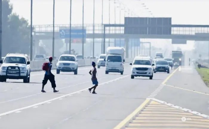
Navigation apps are under scrutiny as debate intensifies over whether digital rerouting can make the N2 safer for motorists amid ongoing reports of stone-throwing and attacks.
Image: Supplied
The N2 and R300 have featured in reports of brick attacks and robberies targeting motorists travelling to and from Cape Town International Airport. The corridor has become known among some commuters as the “Hell Run” because of incidents in which vehicles are damaged to force drivers to stop.
At the heart of the debate is whether crime data — often incomplete due to underreporting — can reliably be built into routing systems designed primarily to save time and avoid congestion, rather than prevent attacks.
Treleven believes navigation companies should place stronger emphasis on safety when directing motorists.
“I think digital navigation companies should either put warnings on maps... however these may be to the detriment of businesses in those areas...but they should certainly route persons leaving or going to airport onto busier, safer routes even if they are longer distances...but lives saved comes ahead of travel distances I believe.”
The debate also carries broader implications. Formal hotspot warnings could affect surrounding businesses and communities, while algorithm-based rerouting may shift traffic and potentially risk onto alternative routes.
Smith, when asked how effective algorithm-based rerouting would be as a crime prevention measure along the N2, referred back to the City’s earlier response.
On the proposed safety wall, he said: “It is too premature to comment.”
Beyond digital engagement, Smith said the City’s enforcement agencies conduct daily patrols on the N2 and R300 during the day and night. He added that the Traffic Service’s Highway Patrol Unit has been operating since 2022, and that last year the City expanded capacity with 40 additional Metro Officers.
“It is important to highlight that the South African Police Service (SAPS) is the lead agency on crime prevention, with the City’s enforcement agencies acting in a supporting role where possible, but due to the many demands on our services, it is not possible to maintain a continuous static presence at any one particular spot,” Smith said.
Meanwhile, discussions between different spheres of government regarding broader safety interventions are continuing.
Councilor Rob Quintas, the City’s Mayco Member for Urban Mobility, said: “Stakeholder engagements are underway and once formal agreements have been reached from all stakeholders, the City will communicate at the appropriate time.”
As mapping technology increasingly influences how residents and visitors move through Cape Town, whether navigation apps can meaningfully reduce risk on high-traffic corridors or whether they simply redirect it remains an open question.
Concerns about digital routing are not new. Two years ago, an American tourist, Walter Fischel, was shot and robbed after a navigation system directed him through Nyanga while travelling from the airport to Simon’s Town.
Following Fischel's shooting in Nyanga, the local CPF welcomed Google Maps' decision to remove the dangerous route from the app.
This follows the 2023 death of British surgeon Dr Kar Hao Teoh, who also mistakenly drove into the area during the taxi strike. Google South Africa director Alistair Mokoena confirmed the removal of the route, a move Fischel hailed as "fantastic."