Understanding Cape Town's groundwater crisis: insights from recent research
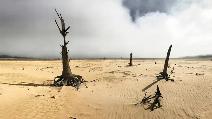
Can a repeated scenario be expected? A portion of the Theewaterskloof dam, close to empty in 2018, showing tree stumps and sand usually submerged by the water of the dam.
Image: Halden Krog, AP
Water demand in Cape Town is placing increasing pressure on the city’s supply, with dam levels dropping to 47.8% in April and City officials warning that water restrictions could be introduced later this year if daily consumption does not decline. Groundwater plays a crucial role during dry periods but this reliable reserve is on the decline.
A new study by a University of Western Cape (UWC) researcher cautions that while groundwater often helps cities and municipalities cope when dams and rivers dry up, fully understanding how it works is equally important. Such understanding could help policymakers to decide how much water can be used safely and improve how water levels are monitored over time.
In his PhD thesis, which analysed groundwater levels from 2007 to 2024 using borehole data, lead researcher Dr Sesethu Fikileni, in collaboration with fellow researchers, Sandiso Zulu and Thokozani Kanyerere from the Department of Earth Science, have confirmed that Cape Town’s main aquifer system is not only double-layered and separated by rock formations (Malmesbury Shale) that still allow water to move between upper and lower aquifers, the study also reveals a steady decline in groundwater levels across much of the city
Using a homegrown mathematical modelling tool, scientifically known as a groundwater simulation framework, to predict water availability and flow direction for both the Cape Flats Aquifer System and Malmesbury Shale Aquifer System, researchers found that 80% of boreholes showed long-term decline, with drops ranging from nearly two metres to as much as 17 metres over the study period.

Dr Sesethu Fikileni during his graduation in December.
Image: Shelley Christians/UWC
The new data show clear seasonal patterns: groundwater levels rise after winter rains and become shallow between August and October. During dry periods, groundwater levels dropped, especially in areas affected by drought, particularly in Cape Town from 2017 to 2019. Boreholes tapping the shallow Cape Flats Aquifer were particularly vulnerable to these dry conditions.
While a small number of boreholes showed rising groundwater levels, researchers have noted these increases were likely due to irrigation, accidental recharge from leaking infrastructure, or water leaking from the deeper aquifer into the shallow one. In the study's findings, they note that increasing urban development is likely reducing natural recharge by limiting how much rainwater soaks into the ground.
In some cases, groundwater levels appeared to be influenced more by human activity, such as abstraction, irrigation, and infrastructure leaks, than by rainfall alone. Researchers argue that treating Cape Town’s aquifer as a single water layer could yield misleading results and lead to poor management decisions. Instead, groundwater planning, monitoring and modelling must recognise the dual nature of the aquifer system.
Dr Fikileni said the latest groundwater modelling is crucial, as accurate predictions and the flow direction of underground water would help policy makers make better decisions and plan more effectively when allocating water resources to where they're needed most, and help avoid overuse of this complex water resource.
“To address the challenges of sustainable groundwater management, it is crucial to have a good understanding of the current status and to forecast future states of this indispensable resource. Therefore, modelling is the cornerstone for future preparedness during extreme weather events like droughts and floods,” he said.